


A6 - Shap Summit, Westmorland
Introduction
Steven Jukes e-mailed me recently to say that he had been out and about between Kendal and Penrith, and did I want some pictures of the A6 over Shap Summit for Rural Roads? Yes please, I replied, and with a couple of exceptions, the pictures in this section are those provided by Steven, for which I am extremely grateful.
Until 1970, and the completion of the M6 between Kendal and Penrith, the A6 across Shap summit formed the main north-south route, linking the industrial areas of north-west England with Scotland. The route was busy, and notoriously hazardous in poor weather conditions. To find this area on a map click here.
Much of the route of interest to us forms the eastern boundary of the Lake District National Park, although there are plans afoot to extend the National Park to the east as far as the M6 motorway. Further plans exist to extend the Yorkshire Dales National Park westwards so that it too reaches the M6.
The pictures appear roughly in north-south order, beginning with one of the few remaining three-laned suicide lane carriageways left in Britain, to the north of Shap village.
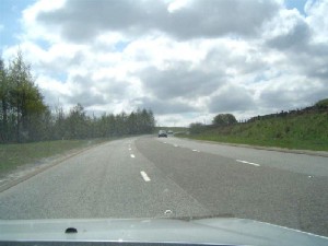
Now that the M6 takes the strain of most of the north-south traffic in the area, the A6 is now lightly trafficked. But imagine how busy this road must have been prior to the motorway, when the third lane provided welcome relief for faster vehicles to pass slower-moving lorries on this important trade route.
The down side of this arrangement, and the reason why most examples have now disappeared, is that there is nothing to indicate who has priority over the use of the middle lane. This led to a large number of head-on collisions, many of which were fatal. I can only assume that when the M6 opened, traffic levels dropped on the A6 to such an extent that the likelihood of a head-on collision along this stretch all but disappeared.
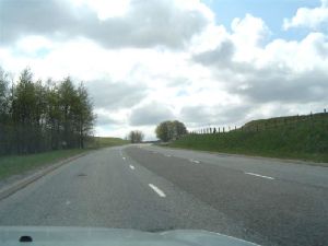
Here we move to the south of Shap village. Once again, the road opens out to three lanes, but this time we two lanes running up the hill southbound, which is segregated from the solitary northbound lane by double white lines.
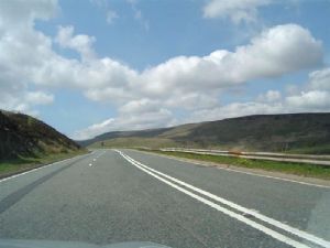
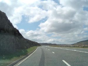
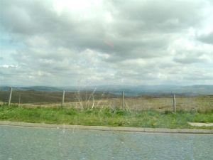
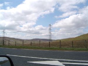
The next two pictures show how the road fits in with the landscape. The terrain is wild and uncultivated, and the skyline unspoilt by modern development - except, that is, the pylons in the second picture.
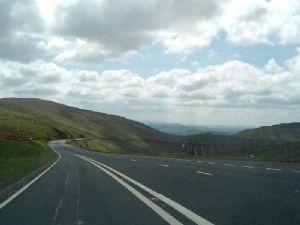
Once again, we are looking southwards along the A6, as the road continues to climb towards the summit. Still three lanes, but with double white lines adding a sense of security to the layout. The terrain is bleak - look how open the countryside is. The road is empty - the three lanes being the only clue that this was once a very important link between England and Scotland.
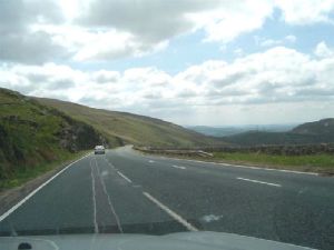
I think these two pictures were taken just to the north of Shap summit itself - the pictures appear to show the road cut into the hillside to the left of the road, and at this stage we cannot see the pylons that cross to the west side of the road between here and the summit.
A6 Shap Summit - Page 1 - Introduction
A6 Shap Summit - Page 2 - Summit and Memorial
A6 Shap Summit - Page 3 - South from the Summit
A6 Shap Summit - Page 4 - Return from the Wild
A6 Shap Summit - Page 5 - Approach to Kendal
Rural Roads Home
Text Copyright © 2005 Simon Davies
Pictures Copyright © 2005 Steven Jukes, except where noted. Reproduced with grateful thanks.