


The Wrynose Pass
The First Climb
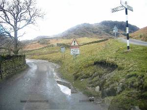
After passing over the high ground separating Great and Little Langdale, our road descends towards the Little Langdale Valley floor. Before long, we reach a T junction with the main road (I use the term loosely) through Little Langdale. We turn right, and are almost immediately confronted by a sign warning us of the dangers of the Wrynose and Hardknott passes in wintry conditions. (Photo courtesy of Nic Storr) Perhaps the gate is a warning as well.
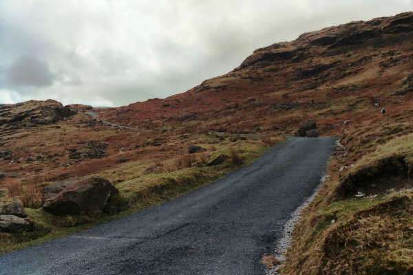
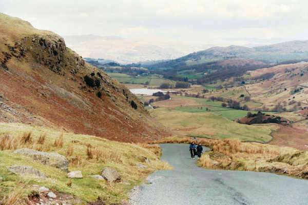
The climb up the Wrynose Pass begins innocuously enough - it is no steeper than the road we've travelled from Great Langdale on (though to be fair, that would rate as steep to many people). We hug the southern flank of Wrynose Fell, along a road that is surprisingly straight to start with. As we climb the pass, there are occasionally places where you can stop the car and look behind you - the first photo on this page illustrates the view back down into Little Langdale - the Lake visible in the distance is Little Langdale Tarn. Higher up the climb, we reach the steep hairpin bends that the are characteristic of the Wrynose and Hardknott passes, and before long, we reach the Three Shires Stone, marking the top of the pass, and the point where the three historic counties of Lancashire, Westmoreland and Cumberland used to meet. These days it is all Cumbria, but the old county names remane significant to locals.
Unfortunately, on my last visit, there were too many cars stopped near the stone to enable me to stop safely and take a picture, so that will have to wait for a return trip.
Nic managed it, though!
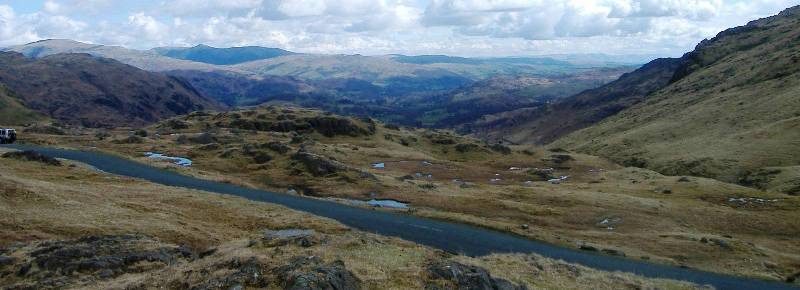
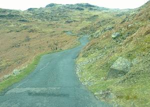
The Wrynose pass reaches an altitude of 393m or 1,281 feet. The descent into the Duddon Valley or Wrynose Bottom is an unremitting sequence of steep hairpin bends (left), but the view in front is quite stunning. You can see (when pointing in the right direction) Wrynose bottom opening up before you, with the Hardknott pass appearing in thye distance. On the return journey up this section, there is that decidedly uneasy feeling resulting from you losing site of the road below the line of the bonnet from time to time, as you pick your course through the hairpins. Instead of the usual need to observe what is happening in front of you, it is sometimes necessary to try and anticipate what is going on 2om to your right and 10m above you, as the road winds through the hair pin bends.
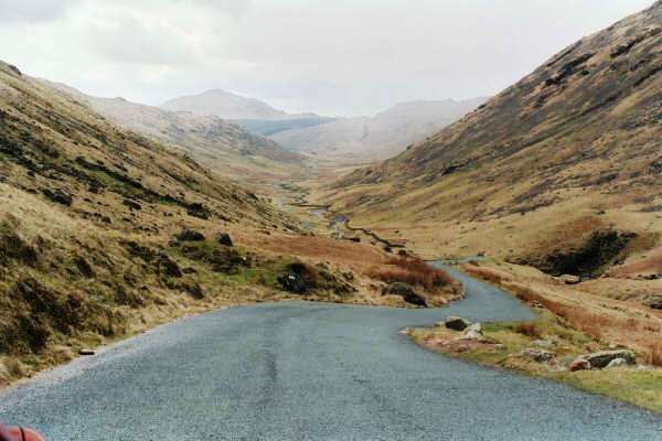
After descending to Wrynose Bottom, the road, still relatively narrow, meanders alngside the River Duddon. To the right, there is a footpath running paralle with the road - this is the remains of the old Roman Road. If you come here very early in the morning you will get a sense of solitude, but later in the day the road gets very busy, partly because the road is the only link from the central lakes to the west coast, but also because of the notoriety of the Wrynose and Hardknott passes.
Wrynose and Hardknott Pass - Introduction
The Route - Great Langdale
The Wrynose Pass
The Hardknott Pass
The Descent to Eskdale
Other Lakeland Passes
Copyright © 2004 - 2005 Simon Davies